Located between Napier and Gisborne, the lovely riverside town of Wairoa is a handy place to stop off and an ideal starting point for exploring the wider district. The district offers something for everyone - the rugged wilderness adventurer, art-collectors and beach-goers. It makes us second to none.
The town of Wairoa got its name from the “Te Wairoa Hōpūpū Hōnengenenge Mātangi Rau” river which in Māori language means “the long water which bubbles, swirls and is uneven”. The ancestral canoe Tākitimu travelled up the river and landed near where the Tākitimu marae (meeting house) now sits.
Te Wairoa Hōpūpū Hōnengenenge Mātangi Rau (the long, bubbling, swirling, uneven waters) is the full name of the Wairoa River and refers to its turbulence and hidden currents. Ruakituri, Hangaroa, Mangapoike, Mangaaruhe and Waiau Rivers are all tributaries of the Wairoa River.
The first bridge was built in 1888 and damaged in the 1931 Hawke’s Bay earthquake. The second bridge was opened in 1933 and destroyed by Cyclone Bola in 1988. The present bridge was opened in February 1990 by Queen Elizabeth II.
Frasertown is a small rural settlement west of Wairoa, with a long history. Frasertown was originally called Te Kapu, but was re-named by early settlers after Brevet-Major James Fraser, who captained military forces in Wairoa in the 1860s.
Te Reinga is a small settlement about 34kms north of Wairoa. Trout fishing in this area is world renown and the cave system is recorded amongst some of the most extensive and fascinating in New Zealand. Rocks in this area are of great interest as they are heavily encrusted with ancient shell fossils.
Taniwha: Tupaheke
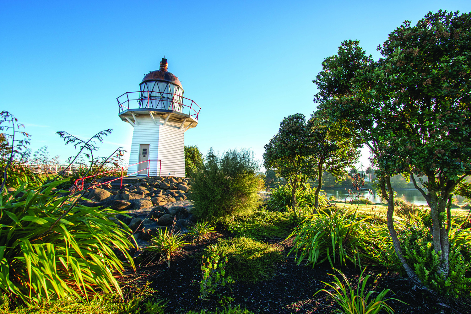
Tupaheke is the guardian taniwha of the Wairoa River as it enters the sea. He is said to have arms like a great crab and is harmless to local people. However, according to local tradition, if a stranger touches the rock it is said they will suffer misfortune.
Taniwha: Tapuwae & Te Maaha
Tapuwae’s first wife was Te Rauhina and his home was on the western side of the river. He was in a continual struggle with his younger brother Te Maaha, who lived on the eastern side of the river, as to where the entrance to the sea was (approximately in the 1400’s). The brothers struggled about the entrance to the river because they each wanted it to be closer to their side of the river, so that the distance to go to catch fish would be shorter. The bar is said to still shift today at the whim of the two brothers as they continue to struggle.
Te Rauhina
Te Rauhina was known to be a lovely, forgiving and peace talking person, her home was a sanctuary for others. She lived on a small island in the Wairoa River with her three children. During heavy flood the river had created a channel and separated what was approximately ten acres from the mainland. The island gradually disappeared over time as the Wairoa River changed its course.
The original name of Frasertown, Te Kapu, is short for “Te Kapu o taku ringa” (the palm of my hand). When Pitiera Kopu (one of the chiefs in Wairoa) married Merekaraka he told her he would always protect her and keep her and her lands in the palm of his hands.
According to one legend of Ngāti Hinehika, two taniwha (water spirits) named Hinekorako and her brother Ruamano once decided to race to the sea. On their journeys Hinekorako curved the Hangaroa River, while Ruamano left the Ruakituri River in his wake. Hinekorako was leading the race and decided to stop at Te Reinga. Ruamano came close behind and crept by in order not to bother Hinekorako. Eventually, he moved ahead to the ocean and won the race by leaving Hinekorako behind at Te Reinga.
Te Urewera is renown for its breath-taking beauty as well as its stormy history. The sparsely populated hill country is the historical home of Tūhoe, an iwi (Māori tribe) known for their stance on Māori sovereignty. It extends over 2,127 km² and is almost 600m above sea level. The winding scenic Te Urewera Rainforest Route (SH38) from Wairoa traverses the tribal territories of seven iwi as well as lush native rainforest.
Along the gateway to Te Urewera, there is a huge selection of walks and tracks. There are short strolls to waterfalls, lakeside swimming spots, one of the biggest rata trees in the country, cave exploring tracks, climbs to lookouts and multi-day hiking adventures. This is home to Lake Waikaremoana Great Walk, one of the great nine walks of New Zealand.
Waikaremoana is a name that encompasses both the lake and the settlement. The beautiful lake, which is sometimes described as ‘an inland fiord’, was formed about 2,200 years ago by a huge landslide caused by an earthquake that blocked the Waikaretaheke River.
Waikaremoana Holiday Park and Te Wharehou o Waikaremoana (Te Urewera Visitor Centre) are situated on the edge of Lake Waikaremoana and are the first stop if you want more information about the area and walks or want to hire equipment.
Te Kura Whenua - Visitor Experience Centre
+64 6 837 3803
6249 Lake Road, Te Urewera 4195
Tuai is a small settlement at the shore of the hyrdo-lake Whakamarino, about 11kms from Te Wharehou o Waikaremoana Visitor Centre.
Three hydro-electric power stations - Kaitawa, Tuai and Piripaua - are fed by nearby Lake Waikaremoana. The first one at Tuai was constructed in 1929. Now the scheme makes use of Waikaremoana’s water by carrying it to Kaitawa Power Station and then, via Tuai station into Lake Whakamarino. The water then passes on to Piripaua Station before being finally discharged into Waikaretaheke River. The stations normally operate as a trio but can also run independently.
Ruakituri Valley has a reputation for having some of the best trout fishing in New Zealand. Hunting is another popular pastime. There are a number of places where river access is possible. The areas of native bush lining the hills make it one of the prettiest spots to visit.
Māhia Peninsula is a hilly promontory projecting south into the sea, between Poverty Bay and Hawke’s Bay. According to Māori legend, Māhia Peninsula is Te Matau a Māui - the fish-hook of Māui. The name Māhia means ‘indistinct sound’.
The peninsula has a number of beautiful beaches and peaceful holiday houses, and is a natural playground for people who like to surf, fish, dive, kayak, swim and walk. It has an interesting mix of sandy and rocky beaches – some exposed to the ocean swells, others beautifully sheltered.
Discover the black sand of Black’s Beach and the tranquillity of Opoutama and Māhia Beach. If you want to catch some waves, Māhanga Beach, the Reefs and Black’s Beach are great destinations.
Māhia Peninsula Scenic Reserve is another of the “must do” activities when visiting Māhia Peninsula. Make time for a walk in one of the largest areas of lowland coastal forest in Eastland. A 3.5km track takes walkers through a range of different types of native vegetation - one of the largest tracts of lowland coastal forest remaining on the North Island’s east coast. This is a lovely way to escape the sun for a couple of hours.
A special place of interest on the eastern side of the peninsula is Piko o Te Rangi - Coronation Reserve. Within the reserve is a rock with a naturally formed basin. In early settlement times this was used as a font where Māori were baptised into the Christian faith by Bishop William Williams. A hole in the wall of rocks nearby is believed to have been used to store bibles.
In mythology, the claw-like Māhia Peninsula was the barb of Maui’s enchanted fish hook when the Polynesian demi-god caught his great fish and dragged Te Ika-a-Maui (the north Island) to the surface.
On its arrival in Aotearoa, in the fourteenth century, the sacred waka (canoe) Takitimu made its way from its first landing spot at Awanui (near Ninety Mile Beach) down the east coast of the North Island. Eventually the waka arrived at the place called Te Papa near Kaiuku Marae. It was there that the high priest, Ruawharo, left the waka and decided to settle overlooking Māhia Beach. Ruawharo proceeded to plant mauri (life principle) of the whales and fish of the sea which is said to have brought the whales to the bay. The meeting house at Opoutama is named Ruawharo as a monument to the renown tipuna (ancestors).
It was stories of the beautiful Rongomaiwahine that lured Kahungunu to Māhia and when he finally reached here he was delighted to find that the stories were not exaggerated. Kahungunu and Rongomaiwahine were eventually married. This marriage is described as unique not only because of the intrigue surrounding it, but because of how it changed the whole history of the East Coast. This union has brought about the current Ngāti Kahungunu and Rongomaiwahine iwi of Māhia.
Māori lived on Portland Island over 600 years ago. They had easy access to an abundance of fish and shellfish and kept gardens on the eastern side of the island. The original name of the island was Waikawa meaning “Sour Water”.
Captain Cook sailed closely around it in October 1769 but large numbers of canoe parties did not welcome him or his ship so he sailed on. Cook gave the Island the name Portland as it was similar topography to Portland island in England.
In 1837 whalers arrived and Māhia served as a principal whaling base in the North Island. The distinctive fishhook shape of the bay was a natural whale trap and alludes to the rich whaling history of the area. Waikokopu was the first whaling station in the area.
A port company was formed about 1910 as a means of improving facilities for the loading out of farm produce which was being handled by lighters to ships parked some distance off shore. The wharf was no longer required from 1942, when the railway line to Gisborne was completed.
Portland Island today is known as the former location of our Lighthouse. It is the district’s most isolated lonely outpost. A barren wind swept island lying 1.4km south of Māhia Peninsula. It is 3.2km in length, 700 metres at its widest point, 100 metres at its highest point and the top of the Island is almost flat to the cliff edges.
Mōrere Scenic Reserve and mineral pools at Mōrere Hot Springs are one of the “Must Do” activities while in the Wairoa district. Visitors can enjoy the hot and cool pools and the great wilderness on the network of walking tracks ranging from easy 10-minute native bushwalks to challenging two and three hour hikes.
Mōrere Hot Springs are set in 364 hectares of native bush reserve which is one of the last remaining tracts of lowland indigenous rainforest on the East Coast of New Zealand. Local Māori tribes have used the hot springs for many years prior to Europeans discovering them in 1884. Māori spoke of the healing qualities.
Nga Nūhaka is the name given to the village by the first ancestors who lived in the district after travelling from the ancient Māori home of Hawaiiki. Nūhaka is famous for its historic Nūhaka General Store which has been in the same location for more than 100 years - it’s also a good stop if you’re looking for souvenirs. Nūhaka is also host to the world famous Wairoa Māori Film Festival.
At the heart of Nūhaka, on the corner of Ihaka and Mataira Street, is Kahungunu Marae. This beautiful master-carved marae was built and carved by World War II veterans in the late 1940s under the tutelage of John Taiapa.
Whakaki is a small settlement by State Highway 2. Whakaki Lake and Lagoon are home to a variety of birds.
The name Morere only came into existence during the late 1890’s, the traditional name is ‘Ngā Waiariki o Ngāti Rakaipaaka’ (The Hot Springs of Ngāti Rakaipaaka), or more loosely to mean the ‘healing waters’. There was a small lake close to Morere called Maukanui, which was well known for its tuna (eels). Today there is evidence of this occupation with the discovery of storage pits and an old pā (fortified village) site. For many years, local Māori utilised the hot springs for cooking, but through legislation this practice was stopped. The current area became a thermal reserve in 1885.
Situated 30 mintues south-west of Wairoa is the small seaside settlement of Mohaka. During the early 1800’s Mohaka was a thriving village of Māori and European, linked intrinsically by the Mohaka River. Whalers and seafarers would utilise the Mohaka River to bring supplies and materials to the area.
Mohaka is the principal locality for the iwi of Ngāti Pāhauwera, an iwi with a proud history. Mohaka is renown for its fishing and in particular the use of the reti board, an ancient method of fishing still used by locals today. Ngāti Pāhauwera are the guardians of the local hangi stones, a taonga (treasure) of the district.
Today, Mohaka is a quiet settlement, with a school and marae. The local marae, Waipapa-ā-Iwi is home to the famous ‘round hall’ named Rongomaiwahine. Farming is very prominent in this region.
Approximately 10 kilometres from Mohaka is the settlement of Raupunga on SH2. This former railway village once had a post office, shops, garage, movie theatre, railway station and primary school, high school and a Ministry of Works depot. Many of the locals who live there are generational and either worked on the railways, forestry or farms. Raupunga is home to the famous Mohaka Railway Viaduct, which was constructed between 1930-1937 and at a height of 95 metres, it is the highest viaduct in Australisia. The viaduct spans the Mohaka River.
The Mohaka River is the principal river of Ngāti Pāhauwera and travels 172 kilometres from the headwaters of the Kaweka and Kaimanawa Ranges to the river mouth at Mohaka. Other iwi such as Ngāti Hineuru and Ngāti Tūwharetoa are also connected to the Mohaka River. The river continues to be popular for rafting and recreational fishing.
At the mouth of the Mohaka River, you will find all kinds of people hoping to catch fresh fish. Some use surf-casting rods, a few use a ‘kontiki’ and occasionally you might see a local with a strange looking contraption that slices through the water like a shark’s fin. At first glance it looks like a person is playing with some kind of toy, but if you look closer you will soon realise that they too are fishing. They are using an ingenious device known as a reti. A reti is a fishing device controlled from shore by a hand-held line. The reti board is designed to move against the current, dragging a lure and hook. For Ngāti Pāhauwera, fishing with a reti is a way of life and it has been a tradition that has been passed down through generations.
Te Kahu o Te Rangi, who is the eponymous leader for Ngāti Pāhauwera, was marking the boundaries of his iwi, when he was asked to stop near Waikaremoana. During that time he uttered, ‘Tāku rekereke, tāku tūrangawaewae’ (Where I plant my heels, is where I make my stand). This now well-known whakataukī (proverb) is used in reference to control the use, protection, preservation and strategic purpose of the environment and resources of the district, for the betterment of the whānau (family) and hapū (sub-tribes) of Ngāti Pāhauwera.
The sacred mountain of Ngāti Pāhauwera is Maungaharuru, which is located close to Tūtira. Accordingy to Māori history, Tūpai, a tohunga (high priest) of the sacred canoe Takitimu threw his staff, Papauma, high into the air and it landed on the summit of the mountain, and the mountain roared and rumbled every morning and evening as the many birds took flight and returned. It was through this action that the mauri (life-force) of birdlife came to exist, hence the name Maungaharuru (the mountain that rumbled and roared).
Disclaimers and Copyright
While every endeavour has been taken by the to ensure that the information on this website is
accurate and up to date, shall not be liable for any loss suffered through the use, directly or indirectly, of information on this website. Information contained has been assembled in good faith.
Some of the information available in this site is from the New Zealand Public domain and supplied by relevant
government agencies. cannot accept any liability for its accuracy or content.
Portions of the information and material on this site, including data, pages, documents, online
graphics and images are protected by copyright, unless specifically notified to the contrary. Externally sourced
information or material is copyright to the respective provider.
© - www.visitwairoa.co.nz / +64 6 838 7440 / isitewairoa@wairoadc.govt.nz